AGRICULTURAL SURVEYSWhat can Aerial Agricultural Surveys be used for?
Aerial agricultural surveys can be used to preform seasonal monitoring, where ideally an aerial survey is preformed prior to each T1-T3 spray stage to aid variable rate application and monitor the growing season in its entirety. Agricultural surveys enable farmers or any growers to employ precision agriculture, which is the practice of observing, measuring and responding to variability in crops by using geographic position and timing, this then enables the correct amounts of water, pesticides and fertilisers to be used to maximise the yields and minimise the expenditure. Using agricultural survey’s, we can supply aerial measurements for crops to create field health reports containing NDVI, NDRE maps, elevation and DTM (digital terrain model) which can provide a wealth of utility.
Using these aerial survey reports the agriculture sectors can use the information to apply variable spraying, trials and know what nutrients to provide based on your soils fertility. Variable spraying is another cost-effective benefit from aerial agricultural surveys because variation in crop health comes from multiple factors such as soil fertility, cultivation and topology of the terrain, all of which is information you can get from our aerial surveys. This information can then be input into variable rate equipment to adjust spray amounts in the areas that need less or more due to the extraneous variables that our agricultural aerial survey reports cover.
Additionally agricultural drone surveys can be used to simplify trials of different nutrients, herbicides and pesticides, by using aerial data to record and cover the strips of land being tested and provide useful information through our NDVI and NDRE data. Having your trials monitored and recorded and then converted into information saves the time and money because it enables you to see specifically the results of each trial instead of assuming or having to do multiple tests.
Soil fertility is also a metric that agricultural aerial surveys can measure, through plant health information that can be determined from our reports you can also determine your soils fertility in certain areas. This in conjunction with farm management records and soil samples can be used to make well informed decisions on what nutrients to apply during the growing season.
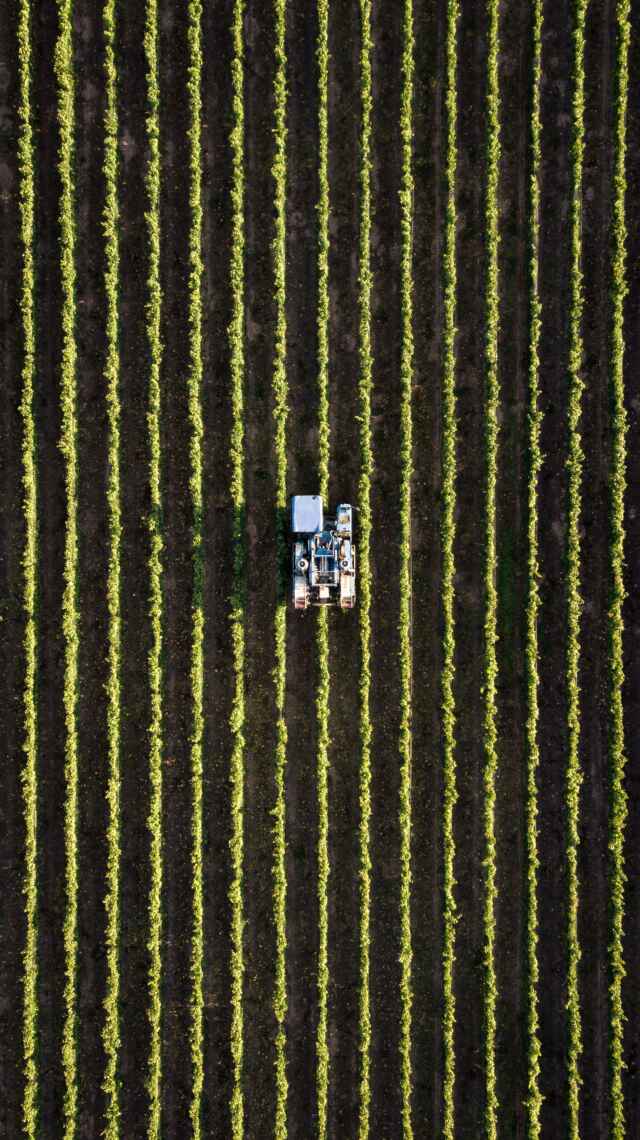
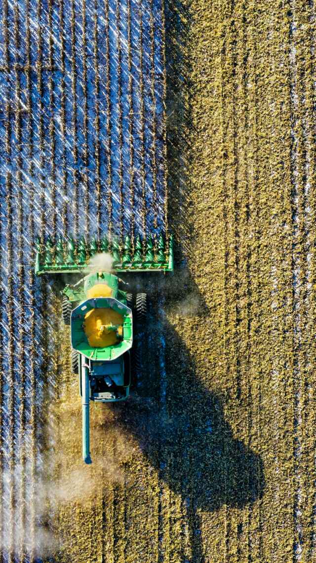
Aerial agricultural surveys also enable you to test your machinery and use aerial data to reveal the performance of cultivation, spray and seeding equipment, which provides you with data and information that can be used to determine if a machine is being wrongly used, requires maintenance or is simply inadequate and needs replacement. Furthermore, all of this information can be tracked using precise scouting which showcases crop health reports and aerial agricultural reports on GPS enabled mobile devices such as iPhones, iPads or Android devices. Meaning that any problems identified on the map or report can be quickly scouted and then dealt with quickly to mitigate any damage that could’ve come from waiting longer.
Aerial agricultural surveys also enable you to test your machinery and use aerial data to reveal the performance of cultivation, spray and seeding equipment, which provides you with data and information that can be used to determine if a machine is being wrongly used, requires maintenance or is simply inadequate and needs replacement. Furthermore, all of this information can be tracked using precise scouting which showcases crop health reports and aerial agricultural reports on GPS enabled mobile devices such as iPhones, iPads or Android devices. Meaning that any problems identified on the map or report can be quickly scouted and then dealt with quickly to mitigate any damage that could’ve come from waiting longer.
How Aerial Agricultural Surveys work?
An aerial agricultural drone survey mission results in several hundred images that must then be combined and matched to create a georeferenced orthomosaic map, which can then have information extracted and extrapolated into several reports and findings. The orthomosaic layer is the stitched visible layer taken during the aerial survey, this is then used to create a digital terrain model to showcase elevation changes and discrepancies. These multispectral index layers can be combined mathematically in different ways to create different maps such as NDVI and NDRE index maps, that represent crop health.
Giving a brief history of the technology we use in aerial agricultural surveys,
• vegetation analysis using NDVI measures was first formulated as part of the NASA Landsat programme in 1972.
• Using a multispectral scanner mounted on a satellite
• This was able to provide data that researchers could find a correlation between the received signals and the biophysical characteristics of the vegetation
• Red Edge (RE) and Near Infra-Red (NIR) light were found to be reflected more dominantly in healthy vegetation.
• These light frequencies are not visible to humans and green crops doesn’t always mean the crop is healthy
Nowadays technology has advanced much further and we are now able to mount the multispectral cameras on small drones, these drones can then be used to carry out agricultural aerial surveys. This is done by flying the drone in an automated grid formation while capturing imagery to create an orthomosaic map of different light frequencies.
See live examples on our Youtube Channel
Other Dorset Drone Services provided
Along with Aerial agricultural surveys, we also offer a selection of other drone services. These services include:
• Aerial Surveys
• Drone Insurance Surveys
• Commercial Drone Surveys and Inspections
• Aerial Surveillance and Monitoring
• Venues, Concerts and Festivals
• Commercials and Promotional Video Services
All of the above services have more information about them that can be found by clicking the links to them above.
Additional Information on our Drone Services
Aerial Surveys
Our drone’s HD video capability and mobility ensure that we get the best end product for our aerial drone surveys, and our experienced drone pilots ensure that the drone is positioned perfectly to provide the perfect end product.
Commercial Drone Surveys and Inspections
Beneficial in situations such as building sites, we carry out drone inspections and commercial drone surveys to assess if an area is safe or collect visual data about the condition of an asset, without putting anyone at risk.
Drone Insurance Surveys
Hard to access locations can be accessed easily and due to our drone insurance surveys our drones can assess the risk and collect data used to decide insurance claims quicker and safer.
Venues, Concerts and Festivals
We have vast experience monitoring venues, parties and festivals for security purposes. Our drones can monitor everyone from a Birdseye view and make sure everyone stays safe and report any incidents that might lead to harm.
Areas we cover:
Covering all areas of Bournemouth, Poole and Christchurch, Dorset, South Wales, Hampshire & Surrey,